Picture this: you’re dreaming of an epic cross-country adventure, a journey spanning thousands of miles across America’s most rugged and breathtaking landscapes, far from the paved highways. You imagine vast deserts, dense forests, winding mountain passes, and historic backroads, all part of the legendary TransAmerica Trail. For years, this incredible overland route, a patchwork of dirt roads, gravel paths, and two-track trails stretching from the Atlantic to the Pacific, has been a closely guarded secret among dedicated adventurers and off-road enthusiasts. Its allure lies in its remoteness and the challenge it presents, but that very remoteness also made it inaccessible to many, confined to detailed paper maps and GPS tracks shared within tight-knit communities. (It was almost like a whispered legend, you know?) But now, thanks to an ambitious partnership and a very capable vehicle, that dream is no longer a distant fantasy. The iconic Ford Bronco has spearheaded a groundbreaking expedition, meticulously traversing the entire length of the TransAmerica Trail to capture every twist, turn, and scenic vista for Google Street View. This monumental effort isn’t just about adding more roads to Google Maps; it’s about democratizing exploration, inviting millions of virtual adventurers to scout, plan, and ultimately experience the raw beauty of the American hinterland. (Honestly, it gives me chills just thinking about it!) This fusion of rugged capability and cutting-edge mapping technology is truly a game-changer for anyone with an adventurous spirit.
The Untamed Beauty of the TransAmerica Trail: A Journey of Discovery
The TransAmerica Trail, often affectionately referred to as the TAT, isn’t merely a route; it’s an experience, a pilgrimage for those seeking to truly connect with the diverse landscapes of the United States. Conceived and meticulously plotted by adventure motorcyclist Sam Correro over decades, this incredible network stretches over 5,000 miles, guiding travelers from the sandy shores of North Carolina all the way to the rugged Pacific coast of Oregon. It’s designed specifically to avoid paved roads wherever possible, instead favoring dirt, gravel, and unmaintained forest service roads that weave through a tapestry of states including Tennessee, Mississippi, Arkansas, Oklahoma, New Mexico, Colorado, Utah, Nevada, and eventually Oregon. Imagine dust devils swirling in the high desert of Nevada, followed by the lush, verdant canopies of national forests in Tennessee, or the ancient, sun-baked canyons of Utah.
“The TAT isn’t just a trail; it’s a living, breathing entity that challenges you, rewards you, and ultimately changes you,” remarks Sarah Jenkins, a veteran overlander who has completed sections of the trail multiple times. “Every mile tells a story, from the small forgotten towns to the vast, silent wilderness. Until now, experiencing it often meant committing to weeks or even months of planning and execution, relying heavily on community knowledge.” The trail’s legendary status stems from its unparalleled variety and the genuine sense of adventure it provides. It demands respect, offering challenges ranging from rocky ascents and muddy descents to river crossings and long stretches of isolated backcountry. Its unpredictable nature, combined with its sheer length, has always made it a formidable, yet irresistible, undertaking.
Google Street View: Bridging the Digital Divide to Remote Wilderness
For over a decade, Google Street View has revolutionized the way we explore our world, allowing us to virtually navigate city streets, historic landmarks, and even distant natural wonders from the comfort of our homes. What started as an innovative way to preview urban environments has evolved into an indispensable tool for travel planning, education, and pure curiosity. The technology behind it, often involving specialized camera rigs mounted on vehicles or carried by trekkers, captures 360-degree panoramic images, seamlessly stitching them together to create an immersive digital twin of our physical world. Yet, a significant gap remained: the vast, unpaved expanses of off-road trails and remote wilderness. These areas, precisely where adventurers yearn to go, were largely absent from Google’s extensive visual database.
Bringing the TransAmerica Trail to this platform represents a new frontier for digital exploration. It’s a recognition that not all roads are paved, and some of the most spectacular journeys happen far from the beaten path. “Our mission has always been to map the world, and that world includes the stunning, rugged landscapes that challenge both vehicles and explorers,” explains Lena Petrov, a Google Street View project lead. “The TAT project presented a unique opportunity to push the boundaries of our mapping capabilities and truly bridge that digital divide, connecting millions with a part of America they might never otherwise see. We needed a partner with a vehicle that could withstand the unrelenting demands of such a diverse and challenging route.” The choice of vehicle, therefore, wasn’t just a logistical decision; it was a testament to the ambitions of the project itself.

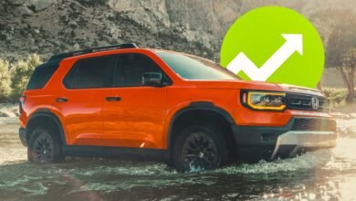
The Ford Bronco: A Purpose-Built Partner for the Ultimate Trail Mapping Mission
When it came to selecting the ideal vehicle to tackle the immense challenge of mapping the TransAmerica Trail, the choice of the Ford Bronco was, in many ways, an obvious one. Its very DNA is steeped in off-road heritage, designed and engineered for the kind of rugged terrain that would easily defeat lesser vehicles. The Bronco, especially in its more capable trims, boasts features that are practically custom-made for an expedition of this magnitude. We’re talking about incredible ground clearance, a robust suspension system capable of absorbing relentless punishment, and advanced 4×4 systems with multiple G.O.A.T. (Goes Over Any Type of Terrain) modes that allow the driver to dial in optimal performance for everything from sand to rock crawling, mud, and slippery conditions.
“There really wasn’t another vehicle that offered the perfect blend of capability, durability, and a heritage of adventure quite like the Bronco,” says Mark Peters, a Ford engineer involved in the project. “We knew it could handle the punishment, but seeing it perform day after day, mile after mile, with all that delicate Google tech mounted on top, was truly impressive. It just eats up those miles, asking for more.” The team made some specific modifications to the chosen Bronco, primarily to integrate the sophisticated Google Street View camera rig. This involved custom roof mounts, ensuring stability for the heavy, precision cameras, and a dedicated power supply system to keep the equipment running continuously through long days in remote areas. Imagine the vibrations, the dust, the sudden drops – the Bronco had to be a stable platform for high-tech optics while simultaneously navigating some of the toughest trails in the country. One particular anecdote shared by a team member involved a stretch in Colorado where a sudden storm turned a dry riverbed into a muddy, rock-strewn obstacle course. The Bronco, leveraging its G.O.A.T. modes, crawled through, cameras still whirring, demonstrating its unwavering capability.
The Expedition: Navigating 5,000 Miles of Uncharted Digital Territory
The task of mapping over 5,000 miles of the TransAmerica Trail was less a drive and more a meticulously planned, high-stakes expedition. The journey required an incredible amount of coordination, endurance, and problem-solving from the dedicated team. It wasn’t just about driving; it was about ensuring the continuous, high-quality capture of imagery, managing logistics in extremely remote areas, and adapting to whatever the trail threw their way. The team comprised experienced drivers and navigators, often rotating to combat fatigue, alongside technical specialists who managed the intricate Google camera system.

Route planning was exhaustive, incorporating weather forecasts, potential fuel stops (which were few and far between in some sections), and contingency plans for mechanical issues or unexpected trail closures. “There were days when the sun beat down relentlessly in the desert, pushing both us and the vehicle to our limits,” recounted Jamie Lee, one of the lead drivers. “Then, in a matter of days, we’d be battling dense fog and slick mud in a forest, barely seeing ten feet in front of the hood. The mental and physical toll was immense, but the knowledge that we were making history, bringing this incredible trail to the world, kept us going.”
The camera system, a specialized version of Google’s roof-mounted Street View Trekker, was robust but still demanded careful handling. Its operation was meticulous; drivers maintained specific speeds to ensure optimal image capture, and regular checks were performed to guarantee data integrity. Imagine the frustration of driving for hours only to find a technical glitch compromised the data! These moments, though rare, underscore the precision required. The sheer endurance of covering over 5,000 miles, day after day, through diverse climates and terrains, truly pushed the limits of both human and machine. From avoiding wildlife encounters to navigating unmapped detours, the team faced a constant stream of challenges, yet persevered, one panoramic shot at a time. The sound of gravel crunching under the tires, the whir of the camera, and the occasional wildlife call became the soundtrack to their monumental undertaking.
Impact and Legacy: Opening the Trail to Millions
The successful mapping of the TransAmerica Trail by the Ford Bronco for Google Street View is far more than just a novelty; it represents a significant leap forward for the entire off-roading and overland community, and indeed, for anyone with a thirst for discovery. For seasoned adventurers, this new digital resource is invaluable. No longer will pre-trip scouting be limited to forum discussions and grainy videos. Now, an overlander can virtually “drive” the entire route, assessing terrain difficulties, identifying potential campsites, and pinpointing critical water or fuel stops with unprecedented accuracy. This enhances safety, improves planning, and democratizes access to information that was once the exclusive domain of a few.
“It’s a game-changer for trip planning,” enthuses Mike Thompson, an active member of several overland forums. “Being able to see the exact condition of a tricky section of trail, or scout a potential dispersed camping spot before you even leave your driveway, is just incredible. It reduces anxiety and opens the door for more people to confidently explore.” Beyond the practical benefits, the project also serves as a powerful inspiration. Armchair adventurers, those who dream of remote journeys but may never undertake them, can now experience the raw beauty of the TAT virtually. This kind of digital exploration can foster a deeper appreciation for wild spaces, perhaps even igniting a spark in future generations of real-world explorers.
For Ford, this expedition solidifies the Bronco‘s reputation as a genuinely capable and adventurous vehicle. It’s a powerful statement about the brand’s commitment to enabling exploration and connecting with its enthusiast base. For Google, it underscores their continuous effort to map the entirety of our planet, pushing the boundaries of what Street View can offer. This isn’t just about mapping roads; it’s about opening a window to the soul of America’s wild spaces, fostering a connection between people and the remote, beautiful corners of our nation. It’s a legacy of accessibility, inspiration, and technological prowess merging with the untamed spirit of adventure.
Conclusion: The Horizon of Digital Exploration Broadens
The epic journey of the Ford Bronco across the sprawling, often unforgiving TransAmerica Trail, culminating in its detailed capture for Google Street View, stands as a remarkable testament to human ingenuity and mechanical prowess. It’s a story where cutting-edge technology met rugged adventure head-on, proving that even the most remote corners of our world can be brought closer to everyone. This achievement doesn’t just put a line on a map; it opens up an entire world of possibilities for planning, dreaming, and experiencing the legendary TAT. It’s a vivid reminder that the spirit of exploration, whether from behind the wheel of a capable off-roader or the screen of a computer, remains a fundamental part of who we are. So, go ahead, pull up Google Maps, zoom in on the TransAmerica Trail, and take a virtual drive. You might just find yourself planning your next big adventure. The horizon of digital exploration has broadened, and it’s more exciting than ever before.
Frequently Asked Questions
| What is the main achievement of the Ford Bronco and Google Street View partnership? | The partnership successfully mapped the entire TransAmerica Trail, an iconic 5,000-mile overland route, bringing its challenging beauty to Google Street View for the first time, making it accessible for virtual and real-world exploration. |
| How does this project benefit adventurers and off-road enthusiasts? | It allows adventurers to virtually scout routes, plan trips with unprecedented detail, understand terrain challenges, and discover hidden gems along the TransAmerica Trail, enhancing safety and preparedness for real-world expeditions. |
| What specific features of the Ford Bronco made it ideal for mapping the TransAmerica Trail? | The Ford Bronco‘s robust 4×4 capabilities, high ground clearance, G.O.A.T. (Goes Over Any Type of Terrain) modes, and durable suspension were crucial for navigating the diverse and often extreme conditions encountered on the TransAmerica Trail. |
| What were some of the key challenges faced during the mapping expedition? | The team contended with unpredictable weather, remote locations requiring extensive logistical planning, mechanical stresses on the vehicle, and the sheer endurance needed to cover over 5,000 miles of rugged, unpaved terrain. |
| What is the long-term impact of adding the TransAmerica Trail to Google Street View? | The long-term impact includes democratizing access to remote natural beauty, inspiring new generations of explorers, providing invaluable data for land management and conservation, and potentially paving the way for more off-road trail mapping on Google Street View. |
Important Notice
This FAQ section addresses the most common inquiries regarding the topic.